^Top image: A road sign announces the beginning of U.S. Route 1 in Key West, Florida, in the 1950's. U.S. 1 runs between Key West and Fort Kent, Maine, where similar signs also announce the famous route’s “beginning.” Numbered highways were introduced nationwide on Nov. 11, 1926. Credit: National Archives
Ninety years ago today, on Nov. 11, 1926, the government of the United States did motorists across the nation a great favor by introducing a national system of numbered highways. Before people started navigating through smartphones with GPS, people actually read maps and road signs to find their way around. Before 1926, however, road maps and signs were often inconsistent and confusing. Many roads had more than one name, and there were no official rules regarding the placement or accuracy of road signs, nor with the upkeep and improvement of the roads themselves. This made for bewildering and sometimes dangerous motor travel.The 1926 Federal Aid Highway System numbered roads to help motorists navigate the growing complex of paved and other roads around the country. The system also spurred improvement in existing roads and bridges and the construction of many new ones. The move to a numbered system came as more and more motorists were traveling the nation’s roads. It became necessary to create a regular and uniform system that would be followed by each of the then-48 states.
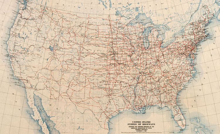
^This map shows the U.S. highway system as it looked on its first day, Nov. 11, 1926. Credit: Bureau of Public Roads/United States Department of Agriculture
Before numbered highways, systems of mostly paved roads called auto trails connected cities and states. Auto trails, however, were often poorly marked, many by simple color bands on telephone poles, and they often “misled” motorists to businesses rather than intended destinations. Some of the better organized and more accurate auto trails still carry their familiar names along with their official numbered routes. Famous auto trails include the Lincoln Highway running between New York City and San Francisco; the Dixie Highway between Chicago and Miami; and the Pacific Highway between Vancouver, British Columbia, and San Diego.
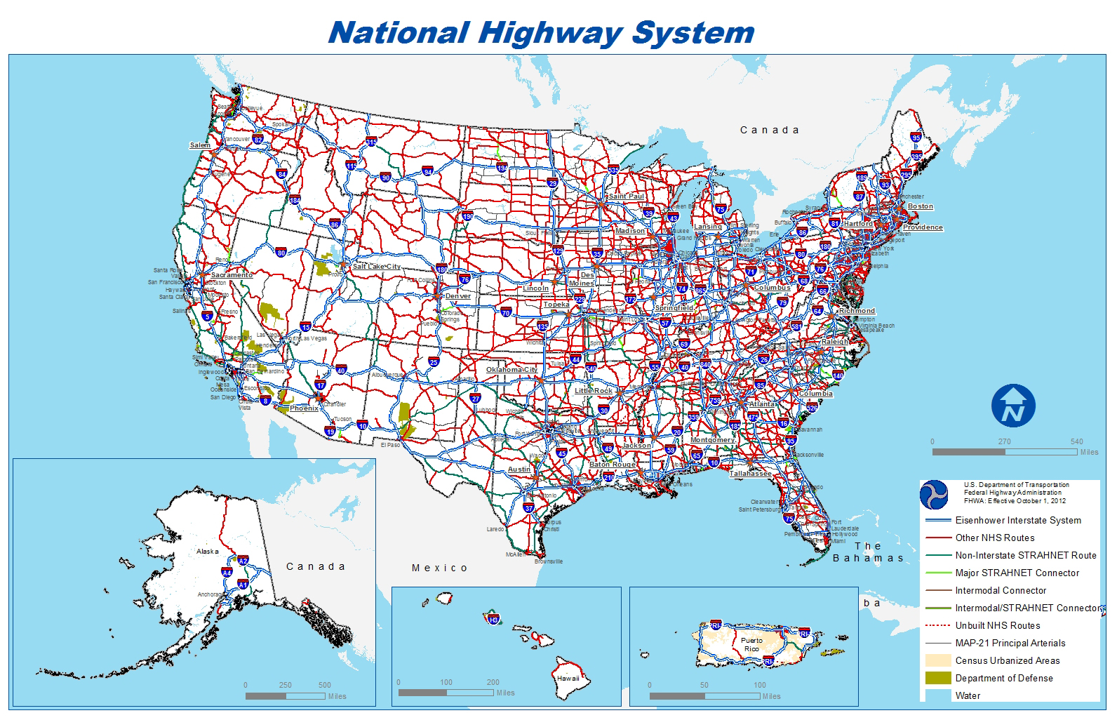
^This map shows the modern National Highway System. Credit: U.S. Department of Transportation
The numbered highway system established a now-familiar plan of motor travel navigation. Generally, north-south highways are odd numbered, with the lowest numbers in the east and the highest in the west. U.S. Route 1, for example, connects Fort Kent, Maine, with Key West, Florida. East-west highways are generally even numbered, with the lowest numbers in the north and the highest in the south. U.S. 20, the longest route in the highway system, runs 3,365 miles (5,415 kilometers) between Newport, Oregon, and Boston, Massachusetts. Major highway routes usually end in 0, 1, or 5. Three-digit numbered highways are side routes that often circle cities or connect other highways. In 1956, theInterstate Highway System adopted this number plan and replaced many of the old U.S. highway routes. Today, the National Highway System includes the Interstate Highway System as well as other roads important to the nation’s economy, defense, and mobility.
View more Behind the Headline stories in World Book Online!
When you need fast, reliable information for homework, reports, or just a lingering question, World Book Online is the place to go.
- A colorful, approachable look and feel, designed for kids, and articles written at your student's level
- Easy access on smartphones and tablets
- Five complete databases for multiple research levels
- Illustrations, maps, audio files, videos, eBooks, primary source documents, and more
Learn More | Buy Now